The GDR RIFT has had its project on the East African Rift approved by CNES as part of the 3rd Call for Ideas (AI3) from the FLATSIM service. This service, operated by CNES for FomaTerre (the data and services hub for the Solid Earth), enables the production of interferograms and time series of surface displacement using Copernicus Sentinel-1 data across vast geographic areas.
A Targeted Project for Optimal Measurements
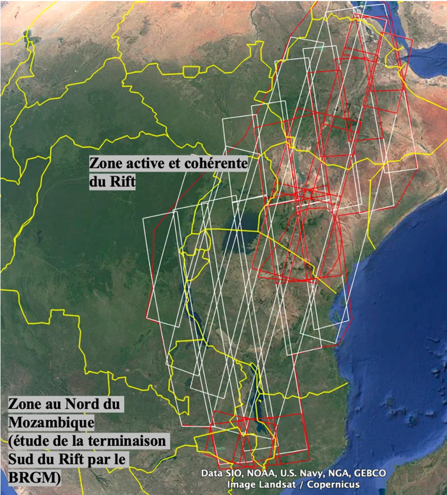
Due to technical constraints, the initial study area was refocused on the regions most conducive to InSAR (satellite radar interferometry) measurements, notably:
- The Northern Rift and its eastern branch, where sparse vegetation allows for more precise measurements.
- Northern Mozambique, to enable the BRGM to continue its work on lateral displacements associated with the opening of the Rift at its southern end.
This strategy was presented and approved at the AI3 FLATSIM kick-off meeting, which was held online on April 29, 2026.
Unique Data for a Multidisciplinary Analysis
Soon, the selected areas (shown in red in the figure) will have a decade’s worth of displacement measurements (2014–2025). The goal is to leverage this exceptional data source to:
- Detect and analyze all surface displacements affecting this active zone, whether they are:
- Geodynamic (faults, volcanoes),
- Natural (loads/lake drainage),
- Anthropogenic (urban growth, groundwater pumping, dam impoundment, geothermal operations).
- Understand the complex interactions between these phenomena and their consequences.
A collaborative workshop in late 2026
To engage the entire scientific community, a workshop open to all will be organized in late 2026. This event will provide an opportunity to:
- Explain in detail how displacement is measured using InSAR and the types of displacements that can be observed.
- Present the available data and areas of interest.
- Initiate discussions and collaborative projects to apply this data in various fields.
More news coming soon!
Contact: Virginie Pinel